Active volcano in Paluweh, Indonesia caught by NASA satellite camera
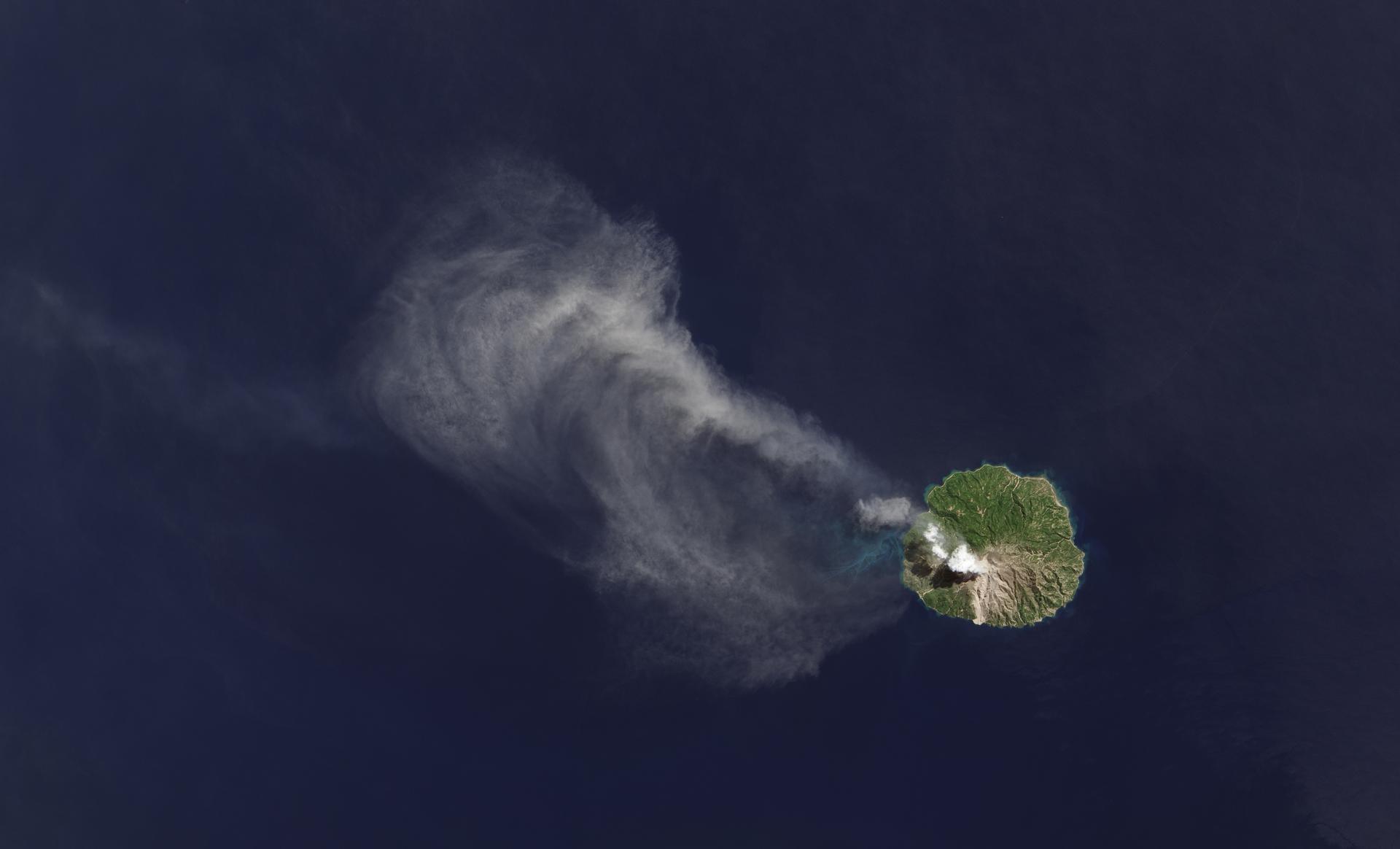
An ash plume drifts from Paluweh volcano in Indonesia in this image, taken April 29, 2013 from the Landsat Data Continuity Misison’s Operational Land Imager instrument.
NASA has snapped a spectacular photo of a volcano erupting in Paluweh, Indonesia from space.
Landsat Data Continuity Mission satellite captured the active volcano from a height of 438 miles above sea level.
Paluweh’s volcano became active in October.
The images were taken by two of the satellite’s instruments: one known as the Operational Land Imager (OLI) and the other, Thermal Infrared Sensor (TIRS).
The first can pick up electromagnetic radiation and heat signatures.
The latter captures infrared heat from the image – the lava in particular.
More from GlobalPost: Mexico's Popocatépetl volcano has erupted
"Each instrument by itself is magnificent," Betsy Forsbacka, the thermal sensor's chief at NASA's Goddard Space Flight Center, said in a statement.
"When you put them together, with the clues that each give you on what you're seeing on Earth's surface, it's greater than either could do by themselves."
The sensors are said to be able to pick up temperature differences as slight as one-tenth of a degree Celsius.
Our coverage reaches millions each week, but only a small fraction of listeners contribute to sustain our program. We still need 224 more people to donate $100 or $10/monthly to unlock our $67,000 match. Will you help us get there today?