360 Degree Street View of the Galápagos Archipelago
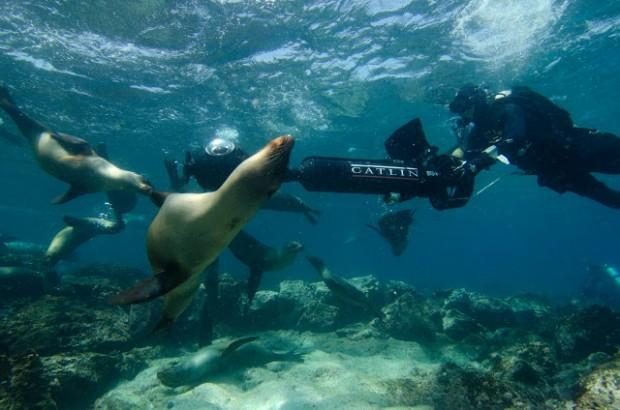
Navigating a SVII camera through Sea Lions at Champion Island in Galapagos. (Photo: Catlin Seaview Survey)
Today's Geo Quiz is on the equator.
Geologist and amateur naturalist Charles Darwin sailed to the Galápagos nearly two centuries ago to investigate and map out the harbors, collect rocks, and study birds. It proved to be one of the most important travel layovers in scientific history.
Recently a team of scientists and Google mapmakers went there to retrace Darwins steps and to capture a 360 degree perspective of the islands.
Can you name the largest island of the Galápagos?
Pirates first named it after a 17th century English duke but in later years it was renamed in honor of a 15th century Spanish queen.
It's home to more tortoises than any other of the islands…and the equator runs smack through the middle of it.
Google's Raleigh Seamster recently explored this seahorse shaped island in the Galápagos. She led a Street View team from Google Maps to survey and map the islands, including the largest island, which was originally called Albemarle but is now known as Isabela Island. Seamster says the team came face to face with sea lions, ventured into the caldera of an active volcano, and visited a marine iguana nesting ground. The hope is that the project makes the islands accessible from home while reducing the pressure on the ecosystem caused by tourist foot traffic.