Is Thwaites Glacier doomed? Scientists race against time to find out.

The Nathaniel B. Palmer arrived at Thwaites Glacier in the early morning hours of Feb. 26, roughly a month after leaving Punta Arenas, Chile. The eastern ice tongue, pictured here, is the most intact portion of the glacier.
Peter Sheehan, an oceanographer on the Nathaniel B. Palmer, was one of the first people on Earth to get this view of Thwaites Glacier — the part that juts out to sea.
He’s pored over plenty of Google images of ice shelves, but there’s nothing like the real thing.
“It looks kind of mystical,” Sheehan whispered as he gazed out from the ship’s bridge before dawn on a quiet, late February morning. “It’s like standing in a cathedral; you feel that hush of reverence.”
The craggy face of Thwaites loomed a few hundred feet away, but seemed almost close enough to touch, or at least within shouting distance. Thwaites was nearly seven stories high here, at its eastern edge, and the bluish cliff glowed against the grayscale sky. It was snowing, and foggy, and the glacier appeared like something out of this world.
The expedition to Thwaites is part of the race to discover how fast the massive glacier is melting and what that will mean for global sea level rise over the next century.
Scientists’ ultimate goal is to develop more accurate global sea level rise models so coastal residents and governments have enough time to plan for future changes. In cities like Miami, possibly the American city most vulnerable to rising seas, infrastructure decisions are made as early as 50 years out.
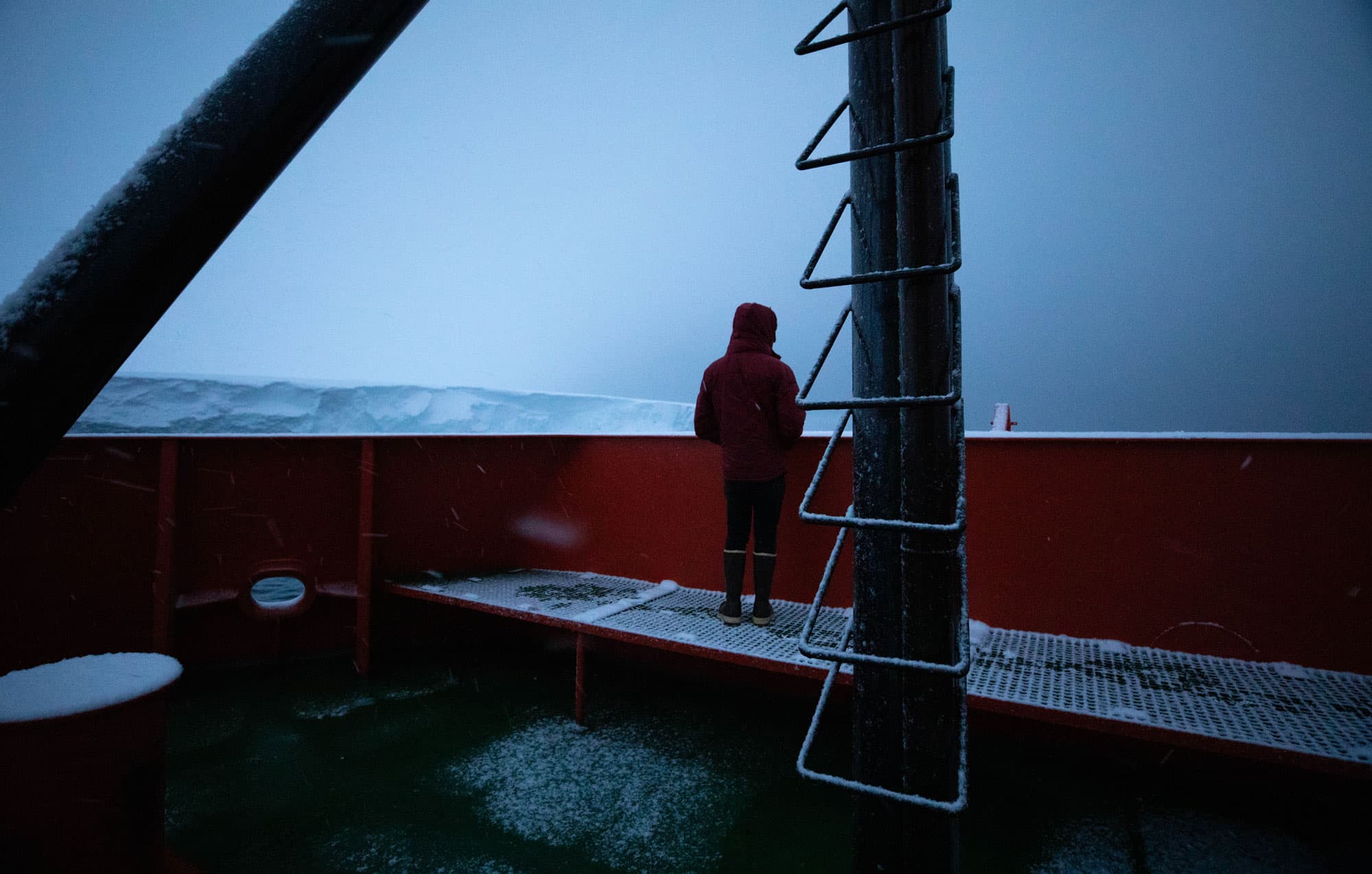
Around daybreak, many of the Palmer’s roughly 60 scientists, staff and crew headed to the upper deck to admire a view that nobody else in the world had ever seen.
“It’s fantastic, this is a critical boundary in the world today,” said Rob Larter, the ship’s chief scientist, upon their arrival at Thwaites. “This is where rapid change is really happening, and we’re actually standing and looking at the bit that’s rapidly changing.”
Normally, most of Thwaites is enshrouded by ice and is totally inaccessible to ships. In fact, some said there was only a 50/50 chance that the Palmer would even get this close to the West Antarctic glacier.
But the timing was right — the winds were good; they blew sea ice and broken bits of glacier out of the way so the research vessel could get through. And when the ship reached Thwaites after a month at sea, the mood on deck was celebratory, with scientists snapping photos and giddily watching penguins swim near the ship’s bow.

Some, like Ali Graham, had prepared for a trip like this for years. “I’ve been working on this area and thinking about it for a third of my life so far,” said Graham, a marine geophysicist at the University of Exeter. “To actually come down and see it up close, you can’t really put into adequate words how special it is.”
Inevitable collapse?
The Florida-sized Thwaites Glacier originates in Antarctica and extends into the Amundsen Sea. It’s melting — fast. And by itself, it contains enough ice to raise sea levels by about 2 feet.
But that isn’t the worst of it. Thwaites sits at the center of the West Antarctic Ice Sheet, and if it breaks off into the sea, it would destabilize nearby glaciers that could, in turn, raise sea levels by roughly 11 feet. Without new infrastructure to protect them, coastal cities around the world would be flooded. Hundreds of millions of people’s homes would be inundated, one study suggests. Lower Manhattan would look something like it did when Hurricane Sandy’s storm surges flooded its streets.
Scientists have known for decades that Thwaites is unstable. The bedrock underneath much of the glacier slopes down toward the continent’s interior, meaning if the ice starts to retreat, there’s little to stop it. And recent modeling incorporating the inherent instability of ice cliffs of a certain height suggest it could collapse much faster than previously thought.
Some scientists argue the glacier’s demise is already inevitable.
“The glacier has already entered the early stages of collapse, and rapid and irreversible collapse is likely in the next 200 to 1,000 years,” wrote University of Washington scientist Ian Joughin and his co-authors in a 2014 paper published in Science.
Larter, the Palmer’s chief scientist and a marine geophysicist at the British Antarctic Survey, says if that’s the case, “the question then becomes, how fast is it going to retreat? How fast are we going to lose that ice?”
Answering those questions is the goal of a five-year, roughly $50 million research collaboration funded by US and UK science agencies that begins with this research cruise to Thwaites. Eight teams of researchers, led by British and American scientists, will study warm water melting the underside of the glacier; how “pinning points,” or ridges in the ocean floor underneath the land-based portion of the glacier will impact its destabilization; and how to forecast or model the glacier’s collapse.
Because as important as Thwaites is to coastal cities from Miami to Mumbai, few people have ever set foot on the glacier, and until now, no one had ever sailed along its face. Thwaites is remote, even by Antarctic standards. With delays, detours and research conducted en route, it took the Nathaniel B. Palmer, the 300-foot icebreaker chartered by the National Science Foundation, a month to get there.

‘The Drake is getting the best of us’
When the Palmer set out from Punta Arenas, Chile, on Jan. 31, it was already behind schedule. A broken rudder kept the ship docked for two days of repairs.
After navigating through the Strait of Magellan, the ship slowed to dodge a storm in the Drake Passage, a strip of open ocean between the bottom of South America and the tip of the Antarctic Peninsula known for its tumultuous weather. When the ship entered the passage, 20-foot swells knocked it from side to side and crashed onto its lower deck.
Inside the ship, chef Julian Isaacs braced himself against the kitchen counter while making meatballs for dinner.
“Right now, the Drake is getting the best of us,” Isaacs said on the second day in the passage, as pots and pans clattered against each other, and an avocado rolled from port to starboard and back again. “We had a lot of things crash to the floor today.”
Down the hall in the ship’s main lab, desk chairs were laid on their sides and lashed to poles to keep them from skittering across the room, while scientists sitting at computers held onto ropes tied to their desks.
Five decks up, Sheehan clung to the metal railing in the stairwell.

“As a grown adult, you never envisage a situation where you need to cling on with both hands, because walking stairs, I can do stairs,” Sheehan said from the bridge where the ship’s bucking was most pronounced. “But no, you can’t do stairs. You’ve got both hands, and you go really slowly.”
That night, in her cabin down on the main deck, Victoria Fitzgerald had a hard time sleeping.
“We were sliding head to toe in the bed,” said The University of Alabama PhD student. “I clung to my sheets like a baby koala, just hanging on for dear life.”

The same ocean that tossed the Palmer around as it traveled, slowly, toward Thwaites, is thought to be responsible for melting the glacier.
Warm ocean water is reaching the part of the glacier that extends out into the sea, and it’s disappearing twice as fast as it did two decades ago. Thwaites currently contributes roughly 4% to global sea level rise, according to NASA, and over the past four decades has spit more than 600 gigatons of ice out into the sea.
Scientists believe the main culprit is a warm, salty mass of deep water that starts in the North Atlantic and rides the ocean currents toward Antarctica. Changing winds are now pushing this warmer water up onto the continental shelf in front of West Antarctica, where it’s eating away at the region’s ice shelves.
Previous expeditions have found this warm water in front of nearby glaciers, but this trip marks the first time scientists will directly measure if, and how much, of it is reaching Thwaites.
“Basically, we [had] no idea what the ocean looks like there,” said Sheehan, who works at the University of East Anglia in the UK and was embarking on his first trip to Antarctica.
“So, that is really exciting. That’s kind of like harking back to the ancient age of Antarctic exploration; we’re going somewhere that no one’s ever been before.”
Changing winds here may be linked to climate change, but a lack of long-term data in the region and a poor understanding of the processes at work means scientists are hesitant to draw a direct connection.
“Essentially, you need 30 years of data before you talk about climate,” said Lars Boehme, an oceanographer and ecologist from Scotland’s University of St. Andrews who attached sensors to seals near Thwaites that will record ocean temperatures and salinity as the animals swim.
Separately, data gathered from sensors on a robotic submarine, deployed by a team led by Anna Wåhlin from the University of Gothenburg in Sweden, will begin to reveal the fine-scale processes pushing warm ocean water up toward Thwaites.
To read into the glacier’s past, University of Alabama sedimentologist Becky Minzoni is examining samples from the seafloor in front of Thwaites.
“To understand present changes and [predict] future changes, you really need to have an understanding of the past,” Minzoni said.
Once Minzoni and colleagues look for markers of warm water in the sediment cores they bring home, they’ll begin to unravel the puzzle of how long this warmer water has been reaching Thwaites, and whether it drove past ice retreat.
This data will help modelers improve predictions of sea level rise, and give places like New Orleans, Minzoni’s hometown, an idea of how to plan for the future.
Nothing goes as planned in Antarctica
Before the research in front of Thwaites could begin, the ship had to get there.
As the Palmer sailed through the Southern Ocean and drew nearer to the Amundsen Sea, marine geophysicists Graham and Kelly Hogan, from the British Antarctic Survey, paid close attention to satellite ice images of the area in front of Thwaites. They hoped to sail right up to the glacier’s face and map the seafloor there for the first time, in part to identify the underwater trenches and channels bringing warm, deep water up to the glacier’s face.
In early February, images showed the sea there was still almost entirely covered in ice. But a few days later, the researchers spotted dark splotches of open water in front of Thwaites.
“That’s the very best situation for us to survey and look at the seafloor,” Hogan said while looking at the black-and-white image in the ship’s main lab.
“It’s really good conditions, and it’s just getting better, so it’s really exciting.”

But nothing ever goes according to plan in Antarctica.
Just hours before arriving at the face of Thwaites, the Palmer reversed course for a medical evacuation.
The 10-day round trip to the nearest science base where a plane could take a sick passenger to a hospital reminded oceanographer Sheehan of how foreign Antarctica is to humans.
“This isn’t our part of the world,” Sheehan said. “For me, this [medical evacuation] just underlines that fact, and how difficult it is to get here, and how difficult it is to understand anything about it at all.”

Is Thwaites doomed?
When the ship finally reached Thwaites at the end of February, it traveled along the roughly 75-mile glacier face to map the previously uncharted seafloor at its edge.
In places like this where glaciers meet the sea, they typically resemble tall cliffs, nearly ruler-straight across the top and uniform in height, like the surface of a butcher-block table. Small parts of the eastern ice shelf where the ship first arrived at Thwaites matched that description.
But as the journey went on, the glacier’s appearance changed and the upbeat mood on the bridge became more somber.
“It doesn’t look like ice shelves I’ve seen before,” said Boehme, the oceanographer and ecologist from the University of St. Andrews.

The top of the ice shelf was wavy and formed an overhang, like a house with snow hanging off its eaves. In some places, instead of ending in a sheer cliff, the ice shelf gently tapered down toward the sea like a sledding hill.
In the late afternoon, jagged peaks stuck out of the ice shelf at weird angles, making the glacier look like a giant pile of rocks covered in snow.
“[It] looks like big icebergs and ice cubes frozen together,” Boehme said. “It looks very chaotic.”
This strange-looking ice face — which the Palmer was sailing across — is vital to the entire glacier’s stability.
It’s where land-based ice flows off the continent of Antarctica and into the sea, forming a floating ice shelf at the edge of the glacier. This ice shelf gets stuck on high points on the seafloor and squeezed from the sides, and acts like a wine cork, slowing the flow of land-based ice from hundreds of miles inland out into the sea. But as this stabilizing ice shelf thins, it lifts off so-called pinning points on the seabed and provides less resistance.
If the shelf thins too much and lifts completely off the seafloor, it’s like the cork is pulled out of the wine bottle, allowing the Florida-sized piece of ice to flow faster and break off into giant icebergs.
This is already happening. Over the last several years, radar imagery shows that warm water eating away at the western part of the ice shelf created a cavity two-thirds the size of Manhattan, big enough to hold 14 billion tons of ice. As the cavity formed, the ice shelf started melting faster, thinning by nearly 700 feet a year between 2014 and 2017.
When scientists saw the ice front in this region up close for the first time, they were surprised by how fractured and fragmented it looked. But they cautioned against drawing any conclusions based solely on appearances.
“It might be that even though the ice shelf looks visually quite different than how I expected it to, that actually it hasn’t changed the way it’s stabilizing the glacier behind,” marine geophysicist Graham said.
Larter, the Palmer’s chief scientist, said at the beginning of the cruise he wasn’t necessarily convinced the collapse of Thwaites was inevitable.
“There’s still a lot of uncertainties, there’s a lot we don’t know about Thwaites Glacier, and that’s why it’s worth doing this research,” Larter said.

Indeed, one of the ice sheet models that set off alarm bells about runaway collapse in West Antarctica depicts two widely divergent futures. In a future where we quickly and radically cut greenhouse gas emissions, the West Antarctic Ice Sheet remains relatively stable for centuries. In a future where carbon emissions continue unabated, warming air temperatures force its collapse within 250 years.
Larter hopes that in five years, after the data collected for the Thwaites research collaboration has been analyzed, we’ll have a better sense of what the future holds. But at the end of the cruise, he was a little more frank with his hunch that a slow-moving disaster has already begun.
“If you’re asking me to project hundreds of years into the future, unless there’s some amazing change where we manage to remove greenhouse gases from the atmosphere, then I think, yeah, the West Antarctic Ice Sheet is ultimately doomed,” he said.
Still, Larter, who has studied Antarctica longer than many aboard the Palmer have been alive, holds out hope: “I hope it’s not as bad as some of us fear it is, because I’ve got teenage children and I’d like them to live in a world where it’s not a disaster scenario.”
This is the first in a series of deep dives into the science and people of the Nathaniel B. Palmer’s 2019 voyage to Thwaites Glacier in West Antarctica. Listen Mondays on The World and check back online through May and June to learn what scientists found as they studied the sea that’s melting this Florida-sized piece of ice.
The article you just read is free because dedicated readers and listeners like you chose to support our nonprofit newsroom. Our team works tirelessly to ensure you hear the latest in international, human-centered reporting every weekday. But our work would not be possible without you. We need your help. Make a gift today to help us raise $25,000 by the end of the month and keep The World going strong. Every gift will be matched 2:1!