Public radio’s longest-running daily global news program.
©2026 The World from PRX
PRX is a 501(c)(3) organization recognized by the IRS: #263347402.
The famous forest will soon appear on Google’s Street View.
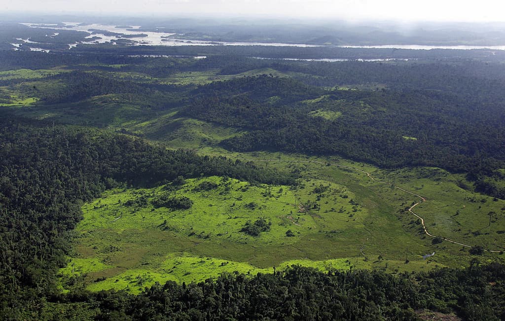
Google cameras see trees of green: the Amazon rainforest.
In its quest to map the entire planet, Google has started in on the world’s largest tropical rainforest.
Google started its Street View in Brazil last year. But until recently, it’s just been focused on the country’s bustling cities and towns.
Now, it plans to send its street-view cameras on tricycles down dirt trails, and even mount them on boats to capture on-the-ground pictures.
Google also will rely on the aid of local people to add details that only they would know, such as well-traveled paths or far-flung villages. The tech giant plans to work with Amazonas Sustainable Foundation, a non-profit organization backed by the Brazilian government that works to conserve the forest and improve the livelihood of communities who live there.
The hope is that it will help outsiders better understand the scope and the importance of the world’s largest tropical rainforest, Google said.
Mapping the forest could bring more pressure to bear on the Brazilian government, as the president considers whether to sign off on a bill that would scale back protections for the famous forest.
Over the years the forest coverage has shrunk as farmers clear the land for their own use, and commercial farms expand. Already, in the past year, Amazon deforestation increased by 15%, according to the National Institute for Space Research.
More from GlobalPost: Brazil offers up land for logging