A forgotten mangrove forest around remote inland lagoons in Mexico’s Yucatán tells a story of rising seas
The San Pedro River winds from rainforests in Guatemala through the Yucatán Peninsula in eastern Mexico.
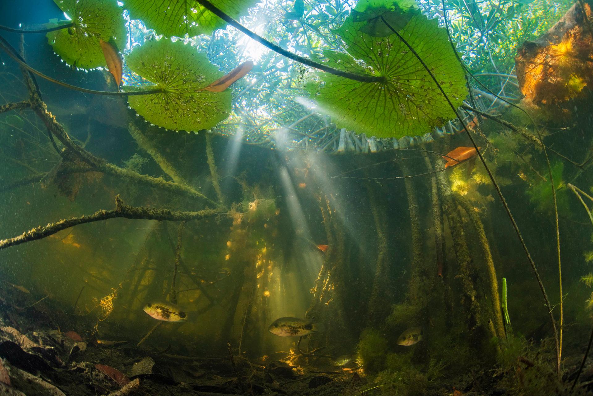
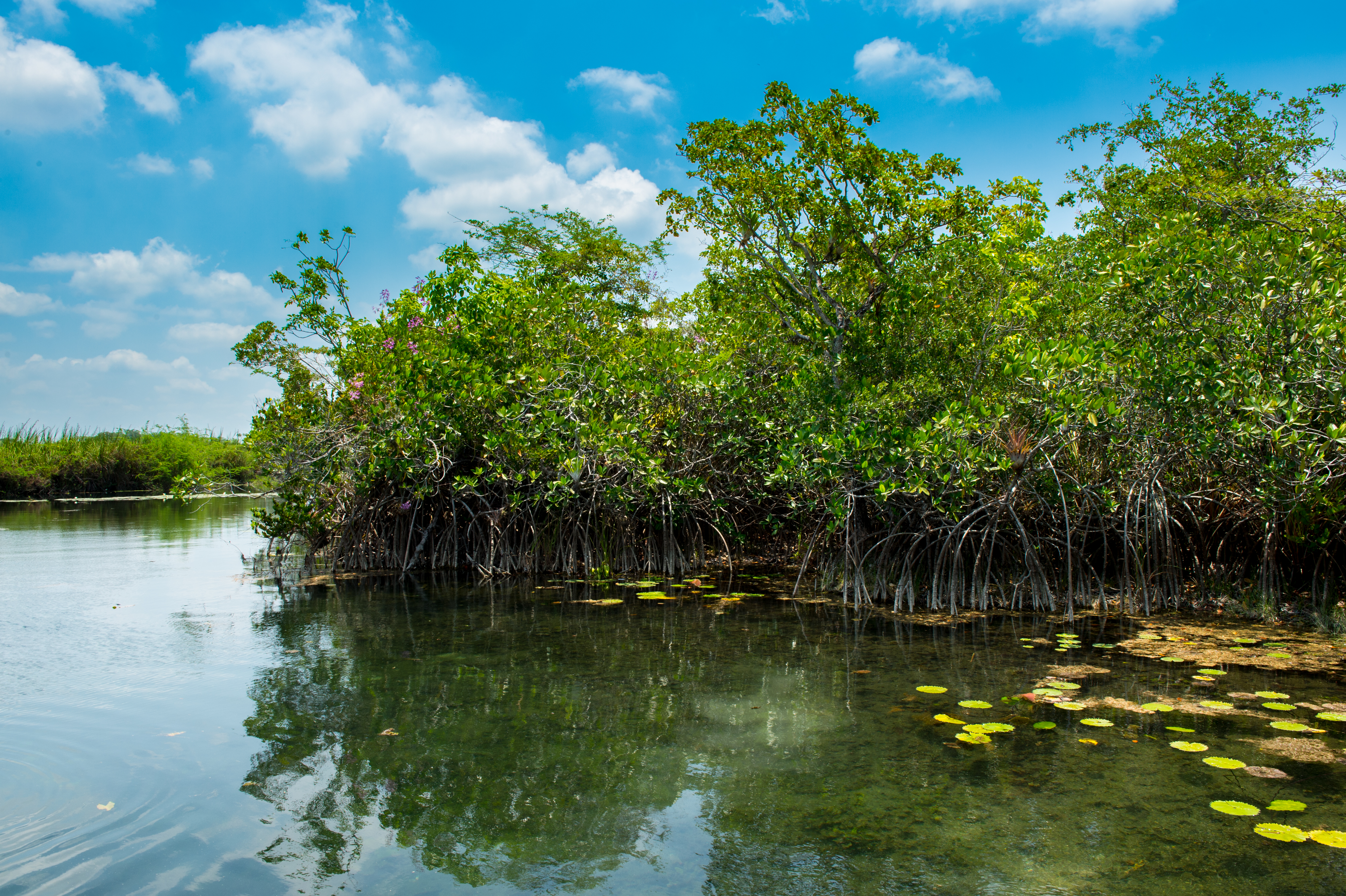
There, this peaceful river widens into a series of slow-flowing lakes. Along a remote 50-mile (80-kilometer) stretch, thousands of red mangroves — trees commonly found along tropical coastlines — line the river’s banks and gentle waterfalls.
Unlike mangroves elsewhere, these trees grow in freshwater. This means that many other species can grow with them: orchids, bromeliads and other air and land plants that cannot tolerate the saline conditions where red mangroves are normally found. It’s a magical garden, and also a scientific puzzle: How did these mangroves come to be growing some 125 miles (200 kilometers) inland, 85 to 120 feet (25 to 37 meters) above sea level, in an entirely freshwater ecosystem?
I am part of a multidisciplinary team of researchers from Mexico and the US that sought to answer this question by comparing these trees to other mangroves across the broader Yucatán Peninsula region. We also analyzed sediment cores from the San Pedro River terraces, which showed strong indications that the sediments had been created in coastal areas.
We found that the mangroves of the river have been separated from coastal mangroves for around 120,000 years. This coincides with the Last Interglacial — a warm period between ice ages, about 125,000 years ago, when glaciers and polar ice caps melted almost entirely.
During that time, the Earth was even warmer than at present and sea levels were 20 to 30 feet (6 to 9 meters) higher. These mangroves’ ancestors were coastal trees that were left isolated as the planet cooled during the Wisconsin Glaciation — the last era when glaciers expanded across North America. As the glaciers spread, sea levels fell, exposing more land around them. Now, this unique forest, a footprint of the past, is at risk of deforestation and development that could prevent scientists from studying it for more insights into Earth’s climate history.

Mangroves and freshwater
The red mangrove (Rhizophora mangle) is an iconic tree that is enormously important to commercial and artisanal fisheries around the world. Juvenile fish shelter among mangroves’ tangled roots, feeding and growing until they are large enough to avoid predators.
Our study focused on two inland lagoons created by giant cenotes — natural sinkholes in the Yucatan’s limestone bedrock — near the Caribbean coast. Red mangroves reproduce via seeds that germinate while they are still attached to mother plants, then drop onto a bank or into the water, where they float away and establish themselves on adjacent banks. This adaptation enables mangroves to spread along coastlines, even though saltwater is toxic to most seeds and makes germination very difficult.
We were fascinated to know how the San Pedro mangroves got there. Their seedlings couldn’t float upstream for so many miles, and the forest on the banks was large and well-established, which made it seem highly unlikely that an animal or human could have brought the seeds inland. To our knowledge, the San Pedro River mangroves are unique in existing so far from the coast.
Isolation and fragmentation
One way to determine where plants may have come from is to see whether they are genetically related to colonies of similar plants elsewhere in a region. So we conducted a genetic investigation that looked for single-nucleotide polymorphisms, or “snips” — differences in a single DNA building block between one plant and another.
We found that the closest relatives to the San Pedro River’s isolated mangroves were mangroves at the Terminos Lagoon on the Yucatán’s western coast, along the Gulf of Mexico. Mangroves from both river communities also were closely related to other coastal populations on the Gulf of Mexico. However, they were very distinct from other freshwater inland mangrove populations in cenotes on the Yucatán’s eastern coast along the Caribbean, and those populations are distinct in turn from other coastal mangroves.
We cored the largest mangrove trees at three sites, extracting pencil-shaped samples from their trunks that showed their growth rings, to get a sense of how long these trees lived — about 100 years — and how many generations of trees had lived there. Then we multiplied that figure by a mean genetic mutation rate to estimate how old the San Pedro mangroves were when they diverged genetically from other mangroves, and how long ago that divergence occurred.
We calculated that the San Pedro River and Terminos Lagoon mangrove populations separated genetically approximately 100,000 years ago. This supports our hypothesis that the San Pedro River mangroves are a relict from the last interglacial, some 120,000 years ago.
Our data also suggests that something drastically reduced the size of the isolated inland population of San Pedro River mangroves. This created what scientists call a genetic or population bottleneck, meaning that its gene pool became much smaller. As a result, the current population has a more unique genetic signature than mangroves elsewhere. Amazingly, this change was caused by just 30 feet (9 meters) of change in sea level.
What else does this unique forest hold?
Our discovery raises an obvious question: Which other species have been isolated in this unique ecosystem for the past 125,000 years? Are there insects? Fungi? We hope scientists who study other types of organisms will explore this area and look for more relicts.
But this special place is at risk. The region was systematically deforested in the 1970s as part of a development plan, but the banks of the San Pedro River escaped the bulldozers because the terrain was challenging. New threats loom today, such as a proposed 950-mile (1,529 km) train route that would carry thousands of visitors to Mayan archaeological sites.
Mayan river systems contain a wealth of cultural and biological riches. Now, we also know that the story of extreme climate change and sea level rise during the Pleistocene is recorded in the DNA of these plants.
They show how dramatically climate change could alter coastal ecosystems along the Gulf of Mexico and many other shorelines if nations do not take urgent action to reduce greenhouse gas emissions that drive climate change. My colleagues and I believe the San Pedro River deserves protection as a testament to both resilience and adaptation in a changing climate.![]()
Sula E Vanderplank is an adjunct professor at San Diego State University. This article is republished from The Conversation a nonprofit, independent news organization dedicated to unlocking the knowledge of experts for the public good.
Our coverage reaches millions each week, but only a small fraction of listeners contribute to sustain our program. We still need 224 more people to donate $100 or $10/monthly to unlock our $67,000 match. Will you help us get there today?
