Help search for missing Malaysian Airlines flight MH370 using crowd-sourced satellite imagery
Malaysian Airlines flight MH370 carrying 239 passengers disappeared somewhere over the South China Sea on March 8 without a distress signal and without a trace.
The search radius keeps growing. Search and rescue operations are now looking at a radius of 100 nautical miles.
It's a huge undertaking, and you can help.
DigitalGlobe, a US satellite imagery company based in Colorado, is recruiting the entire internet. It's identified a search area and made available a crowd-sourcing platform called Tomnod to help scour it, square by square.
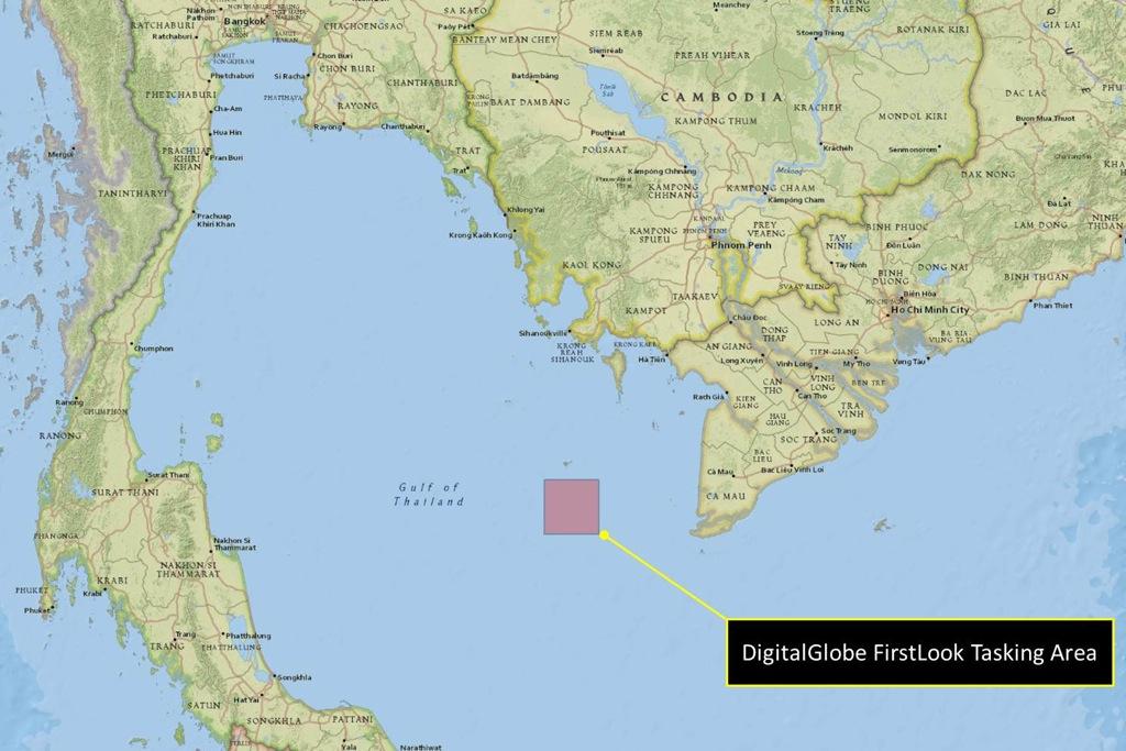
The image above is the search area. It's bigger than it looks.
Tomnod is an easy-to-use web platform that doesn't require a login. Go to the site, and it'll load a portion of the search area. (Check back if the site is down, because traffic is kind of breaking the internet right now.)
You can click and drag around, filling up square after square. Mostly, you'll see empty water and clouds from 100 feet up and squares you haven't visited yet, like this.
![]()
(DigitalGlobe)
But don't give up. Keep clicking. Keep looking. If you see something, you can tag it. Current options are "oil slick," "wreckage," "raft," and "other."
The platform tells you how many squares you've completed, how many objects you've tagged, and how many objects were tagged by other people in the same space.
It's the least you can do while folks at search and rescue headquarters in Hanoi do this:
The article you just read is free because dedicated readers and listeners like you chose to support our nonprofit newsroom. Our team works tirelessly to ensure you hear the latest in international, human-centered reporting every weekday. But our work would not be possible without you. We need your help.
Make a gift today to help us reach our $25,000 goal and keep The World going strong. Every gift will get us one step closer.