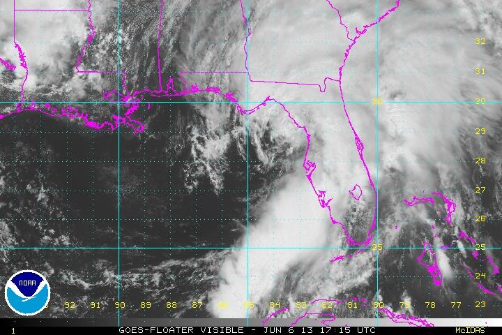
Tropical Storm Andrea slams into Florida coastline
NOAA satellite footage of Tropical Storm Andrea, bearing down on Florida on June 7th.
A tornado hit Florida's Hillsborough county early Thursday morning, as Tropical Storm Andrea — the first named storm of the 2013 Atlantic hurricane season — delivered a drenching to the western coastline of the Sunshine State.
Tornado warnings were issued throughout the Tampa Bay area for Thursday, and tornado activity was confirmed in Pinellas, Hillsborough, and Manatee counties during the early hours of the day, causing downed power lines and some property damage, according to Bay News 9.
Read more from GlobalPost: Second sinkhole emerges in Tampa
Recent updates from MyFoxTampaBay stated that tornado warnings for southeastern Manatee, eastern Sarasota, southwestern Hardee and northwestern DeSoto areas have all been lifted, although passage over the Bay's Sunshine Skyway bridge remains blocked due to high winds.
Winds measuring over 39 miles an hour were recorded across the Florida peninsula, noted CNN, which added that the storm is likely to cross land and then head to the eastern region of the state.
The National Hurricane Center reported maximum gusts of 60 miles per hour for Andrea, and added that the storm "should lose tropical characteristics in about 36 to 48 hours."
The Atlantic hurrricane season formally began on June 1st, and the NOAA is predicting a powerful and potentially destructive year of wild weather.
"This year, oceanic and atmospheric conditions in the Atlantic basin are expected to produce more and stronger hurricanes," Gerry Bell, PHD lead seasonal hurricane forecaster with NOAA’s Climate Prediction Center, said in a NOAA release. "These conditions include weaker wind shear, warmer Atlantic waters and conducive winds patterns coming from Africa."
Every day, reporters and producers at The World are hard at work bringing you human-centered news from across the globe. But we can’t do it without you. We need your support to ensure we can continue this work for another year.
Make a gift today, and you’ll help us unlock a matching gift of $67,000!
