These radar maps show how airlines feel about Ukrainian airspace right now
Ever since Malaysia Airlines Flight 17 crashed yesterday in eastern Ukraine — reportedly shot down by pro-Russian separatists — many airlines have been avoiding Ukrainian airspace and some have suspended flights to Kyiv.
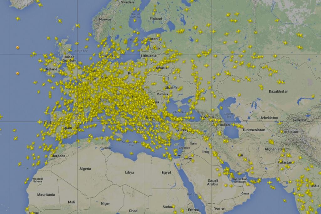
Need an illustration of what that looks like? See above:
That's a radar image from Flightradar24 showing airspace above Europe, the Middle East, and North Africa around noon on July 18. Note the empty space above Ukraine.
![]()
(Screengrab/Flightradar24)
If you go to FlightAware, another flight tracking website, you can compare the flight path taken by the ill-fated MH17, flying from Amsterdam to Kuala Lumpur on July 17, with the path being taken by Malaysia Airlines' July 18 flight from Amsterdam to Kuala Lumpur. Creepily it's also "MH17."
Here's the MH17 that crashed on July 17. Its route crossed directly over Ukraine.
![]()
(Screengrab/FlightAware)
Now look at today's MH17. It's giving Ukraine a very, very wide berth.
![]()
(Screengrab/FlightAware)
The article you just read is free because dedicated readers and listeners like you chose to support our nonprofit newsroom. Our team works tirelessly to ensure you hear the latest in international, human-centered reporting every weekday. But our work would not be possible without you. We need your help.
Make a gift today to help us reach our $25,000 goal and keep The World going strong. Every gift will get us one step closer.